 |
Station Bellingshausen |
[Climatic description][Pressure field and surface wind][Clouds and precipitation]
[Air temperature][Visibility, snow-storms, fogs][Sea ice][Photo Gallery][Climatological data]
| Station synoptic index | 89050 |
| Meteorological site height above sea level | 14.3 m |
| Geographical coordinates | 62 12'S 58 56'W |
Topography and local environment
The Bellinsgausen station is situated on the Filds Peninsula in the south - western part of King-George Island (Waterloo island), being a part of the South Shetland Isles. The coordinates of the station are 62° 12ў S and 58° 58ў W, its altitude is 16 m above sea level. The station buildings are built on free of ice soil, on the both banks of the brook, rising from the small Kiteg lake and flowing into the Ardly bay. This bay is suitable for ships visits, the disembarkation is executed usually with help of floating transport, sometimes by helicopters.
The King George Island is the largest island of the archipelago (its length is about 80 km, its width is 30 km). Most of the island is covered by ice with maximal glacier thickness of 326 m. The Filds Peninsula is the greatest area with free of ice surface, its north-western coast is washed by the Drake gulf waters and its sought-eastern one is washed by the Brandsfield strait. This peninsula is formed from the igneous rocks, the relief is a typical small hills area with altitude up to 150 m and with a lot of fresh water lakes. Most of the year the lakes are covered by ice with the thickness up to 1 m.
The peninsula shores are under sea exposure all the year. Only during separate winter months there is an ice strip near the shore. Usually in the middle of March in the Ardly bay the fast ice is formed, its thickness reaches 80-100 cm to the end of March. Guard-National gulf is cleaned from the drifting ice in September -October. The dates of final fast ice breakout vary in wide limits from October to November.
[top]
Operational reguirements
The Bellinsgausen station was opened in February 1968, the staff in winter season consisted of about 20 persons. The aerometeorological, oceanological, glaciological, geophysical observations were carried out there, as well as biological and medical investigations. The station is used as a base for field rout investigations at the King George island.
In 80-ies the scientific expedition group was working at the station, the duties of which included the providing of ships with the weather forecasts and with the ice situation information for the south-western part of Atlantic and for the south-eastern part of Pacific.
Presently the station is reorganized to the seasonal type (since 1999).
[top]
Weather features and forecasting recommendations
General climatic description and atmospheric circulation features
The climate of Faelds Peninsula is of marine type with small amplitude of seasonal air temperature variations and with intensive cyclonic activity. The weather is unsettled. The gloomy weather with low stratus and strato-cumulus prevails, precipitation is in the form of snow, rain, or drizzle often. Around 729 mm of precipitation falls over a year in average.
The cyclonic eddies move to the considered region along the both zonal and meridional trajectories. For zonal processes the fast moving of cyclones from the West to the East with speeds exceeding ever 100 km/hour is typical. The coming along the meridional trajectories from the middle latitude area of Pacific cyclones are filled over the Bellinsgausen sea.
Not all the cyclones with zonal trajectories move over the Drake strait. Some of them drift father south or father north from the Drake strait and they meet on the way the orographic barriers of mountainous edge of South America or Antarctic Peninsula.
The part of cyclones passes the mountain peninsula and comes to the Weddell sea. This process is accompanied by deceleration of the cyclone before the barrier, sometimes the cyclone is displaced along it and then passes the barrier. Often the part of cyclone cloudiness stays at the windward side of the mountain ridge and defines the overcast weather for a long time if the development of the secondary eddy is supported by the temperature difference increasing which is formed by penetration of cold Antarctic air. Thus, depending on the latitudinal position of the cyclone trajectory the air mass transport at the Bellinsgausen station can be not only western but eastern also. The number of cyclones moving from the West to the Drake strait achieves 6-10 per month. Near the west coastline of Antarctic peninsula this number usually is 2-4 cyclones less. In other words, the number of moving cyclones to northward from 620 S is usually greater, than in the southern area. But in the eastern part of the Bellinsgausen sea the stationary of the coming from the south-eastern part of Pacific cyclones takes place more often than in the Drake strait. This provides a prevailing of frequency of northern outlining area cyclones over the southern outlining area cyclones frequency.
As a result we can note that there are the seasonal features in cyclonic activity characteristics of considered area for many years, but they are not prominent. For example there is a greater frequency for winter season than for summer period of coming along the sharp longitudinal trajectories cyclones in Bellinsgausen sea. Over the northern edge of Antarctic peninsula the blocking ridges of high pressure are occurred more often in winter than in summer seasons, the same is for the penetration of cyclones inside the continental Antarctic areas. Much greater distinguishes are occurred for interannual features and for month to month changes ever during the same season.
Considered above parameters of eddy activity are characterized by prominent inner- and interannual variability. So, from 1983 to the middle of 90-ths ies stable tendency in increasing of the active cyclones number accompanying by the noticeable air temperature rise in the low troposphere is occurred.
[top]
The pressure field and surface wind
The general features of multi-years averaged field pressure in the Drake strait area and their seasonal tendency demonstrate the southward displacement of zonal transport area in summer and in spring. This area expanded to 630 S. Over the Bellinsgausen sea the intensive cyclonic center is formed, which disappears in winter seasons and in its place only the depression of cyclone over the western part of the Ross sea is observed. The similar transformation occurs in the Weddell sea, where the vast and deep area of cyclonic activity is developed in summer, and in winter only the depression of cyclone over the Riser - Larsen and Cosmonaut sea is occurred. In connection with this, in winter the meridional pressure gradients in the area of Drake strait decrease slightly in comparison with the summer seasons, the increased frequency of anticyclonic processes in the southern part of South America and over the Antarctic Peninsula is registered. All these features are reflected in mean annual values of pressure at the Bellinsgausen station, where the standard value for the warm part of a year is 992 mbar, and for June-September it is 994 mbar. The pressure variability is large during all the months of a year (s = 3-5 mbar), the maximum value is registered in July.
At the Bellinsgausen station from the eight basic wind directions the northerly, north-westerly and westerly winds are most frequent, for the most of months and on average during a year the north-westerly winds are prevailed (22%). Total number of northerly, north -westerly and westerly winds directions is 60 % of all observations at the synoptic times, the maximum wind speeds correspond to the same wind directions. South-easterly and easterly winds are the second by frequency and by speed in the wind rose, their share is 26% on average during a year. These winds are most frequent in January, when their share increases up to 38%. Usually the north-westerly winds bring warmth and moisture in the front of cyclones to the station area, and south-easterly and easterly winds are usually cold and dry, like the rear of cyclones. The wind direction and speed are very unstable in the station area. The sharp wind blasts and sudden abatements are typical. The wind speeds achieve the hurricane wind speeds often. On the contrary, the calm weather is occurred very seldom, not often than 3-5% of occurrence, sometimes during the winter months this value can rise up to 6-8%.
The longest strong cyclonic winds occur when exiting of cyclones from the eastern part of Pacific along the sharp meridional trajectories. The number of days with wind speed exceeding 15 m/s is 10-15 per month in average, the maximum falls on winter months. The mean index of storm frequency is about 200 days per year. The maximum wind speeds increase to 28-30 m/s, and separate blows are up to 45 m/s. These blows often cannot be explained by pressure field characteristics, because they are local usually and accompanied by small pressure gradients. In some cases this phenomena can be explained by an arising of mesodisturbances
In the absence of meteorological stations in Bellinsgausen and Amundsen seas the satellite information is the main origin for synoptic analysis there. The modeling analysis suffers from closing of the Russkaia station and from irregularity of observations at the Berd station.
For synoptic situations forecasts the data about fluxes and temperature conditions at levels of 700, 500, 300 mbar play the main role. These data are very sparse in the considered areas, because the number of sounding points is not enough for both synoptic and modeling analyses.
[top]
Clouds and precipitation
The processes of development and distribution of clouds and precipitation are defined by arising and transfer of fronts.
On the base of satellite data the cloudiness distribution is obtained over the Bellinsgausen station area for warm and cold seasons. The distribution of mean amount of cloud cover has zonal orientation in the Drake strait area in summer and in winter, which shows the prevalence of zonal atmospheric processes. The maximum amount of cloud (7-9) occurs inside the latitude band 59-630 S. In the western and eastern coasts of Antarctic peninsula the amount of cloud cover is 8-5 in winter and in summer. When the frontal systems pass the Feilds peninsula the low boundary of cloud does not change, and hills are often inside cloud, if their height does not exceed 100 m above sea level. At the Bellinsgausen station the mean annual cloud cover is 9, the seasonal and month to month variations are very small and don't exceed 1. The clear sky event frequency (with amount of cloud cover of 0-2) is 2-5% of all observed cases for most of months, and only in winter months (June-August) this value increases up to 7-9%.
The frequent precipitation at the station area is defined by high cyclonic activity during all the year. The number of days with precipitation is about 260 days per year. Around 70-80 mm of precipitation per month falls in the period from February to October. In November, December and January the amount of precipitation is slightly less (60-50 mm of precipitation per month), i.e. the annual variation of precipitation amount is almost absent. Though the solid precipitation (snow, snow grains, tiny pellets of snow) are prevailed during all the year, but liquid and combined precipitation are registered not only in summer, but in winter also.
[top]
Air temperature
In spite of insignificant annual temperature variations the temperature forecast is of big interest in some cases. First of all it concerns the temperature drops, which can be significant, but short in time and they are registered not only in winter and in transient periods but in summer also.
The annual temperature amplitude variation is 7.5° in average at the Bellinsgauzen station. The warmest months are January and February with average temperature of about 1° C, and maximum registered temperature is 8° and ever more. The coldest months are July and August (-7.0, -7.4° C). By frosts the temperature falls to -25.0, -30.0° C during these months, accompanied by high relative humidity of the air (not lower than 80-70%).
[top]
Visibility, snow-storms, fogs
Precipitation, snow-storms, fogs are the main reducing the visibility factors in the vicinity of the station. The prevalence of good visibility (greater than 10 km) is registered in more than 90% of all observation times. The frequency of low visibility (less than 2 km) is 2-6 % per month. In winter months it is defined by enough frequent snow-storms (up to 10-12 days), and in summer months the fogs as well as precipitation (up to 8-10 days) are among main reasons of visibility reducing. It explains the small annual variation of low visibility events frequency.
The probability of fog event increases with passage of warm front with northerly winds, the fog can occur ever in presence of strong wind. The snow-storms take place with fresh snow cover and at wind speeds exceeding 7-9 m/s, usually they are accompanied by cyclone transition in winter conditions when the warm front is followed by the cold one. Under the dry snow conditions the probability of snow-storm increases. In other case, when temperature is not enough low, the ice deposition can be registered: the icing-up of surface, of things, of wires as black ice, rime and wet snow. The icing events frequency at the Bellinsgausen station can occur 8-12 days per month during the period from May to September.
[top]
Sea ice
At the Bellinsgausen station the regular ice observations are carried out in Maxuell bay including Ardly bay and in visible aquatories of Brandsfield and Drake straits. The more reliable and full data about ice situation are available for Adrdly bay due to visibility conditions there. Results of observations, carried out from 1968 demonstrate that the ice conditions in this bay are characterized by prominent interannual variations. So, the maximum thickness of fast ice varies from 50 to 124 cm, and the number of days with stable ice (from the moment of stable ice formation to the full clearing from the ice) is from 82 to 220. The presence or absence of ice is recorded by observer reliably ever under a limited visibility conditions, therefore interannual variations of ice season duration let to reveal the general tendency of ice conditions severity for Ardly bay. On the base of these data it can be noted that the most severe period was observed at the beginning of 70-ies. The mild period was registered from 1975 to 1979. Later the period with average conditions began, which transformed gradually into new period of mild ice situation.
[top]
Photo Gallery
 |
Rainbow over the station, season 2002 (photo by O.Sakharov) |
 |
Geliograph, season 2002 (photo by O.Sakharov) |
 |
Automatic weather station MILOS-500, season 2002 (photo by O.Sakharov) |
 |
Radiation tools, season 2002 (photo by O.Sakharov) |
 |
Wind tools, season 2002 (photo by O.Sakharov) |
 |
Lichens (Usnea aurantiaco-atra (Jacq.) Bory (1826) [Syn.: Usnea fasciata Torrey].) in the vicinity of station in July 2002 (photo A.Petpov) |
 |
Photo of station meteo site made July 3, 2002: temperature= -18 ‘, wind 25 m/s (photo A.Petrov) |
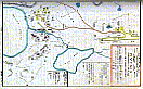 |
Schemes of disposition for Russian station Bellingshausen and Chilean base Teniente Rodolfo March Martin (from the photo archive of 32th SAE) |
 |
Ground surface view under radiometric arrow May, 1968 (photo from archive) |
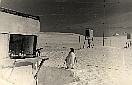 |
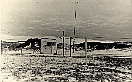
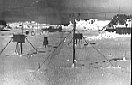
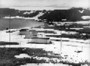
Station meteo place view, May 1968 (photo from archive) |
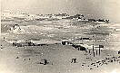 |
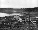
Station view form Northern-Eastern side, May 1968 (photo from archive) |
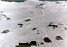 |
General view of the station from helicopter during winter 1987 (photo from archive) |
 |
Place for meteorological measurents (photo by V.L.Mart'yanov) |
 |
Pinguin looking at the station main building (photo by V.L.Mart'yanov) |
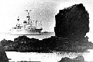 |
R/V "Professor Vise" approaching the station (photo from the archive) |
 |
Place for meteorological measurents, 16th SAE (photo from archive) |
 |
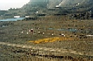
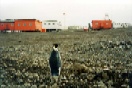
In the vicinity of the station, 47 RAE (photo by A.B.Petrov) |
 |
Construction of new houses, 1975 (photo from the archive) |
 |
The same houses during winter season 1975 (photo from the archive) |
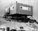 |
Construction of upper-air pavillon (photo from the archive) |
[top]