 |
Mirny Observatory |
[Weather phenomena][Wind and pressure][Clouds and precipitation][Visibility – blizzards]
[Whiteout][Temperature and chill factor][Icing][Sea Ice][Photo Gallery][Climatological data]
| Station synoptic index | 89592 |
| Meteorological site height above sea level | 39.9 m |
| Geographical coordinates | 66°33' S 93°01' E |
| Geomagnetic coordinates | F = -76.8°; D = 151.1° |
| Beginning and end of polar day | 7 December - 5 January |
| Beginning and end of polar night | нет |
Topography and the local environment
Mirny Observatory (opened on February 13, 1956) is situated on the coast of Cape Davis at a small protrusion of Mirny Peninsula at a point with coordinates of 66033’S and 93001’E. The altitude of the station above sea level comprises 35 m. The shore in the vicinity of the station is called Pravda shore. The station structures are located at four rock outcrops. The mainland shore presents a snow-ice barrier of about 15-20 m above sea level. The ice surface south of the station elevates to a height of 1.5 km at a distance of 100 km. A 10-m isobath passes in 15-20 m from the coastline. Offshore there is a group of the rocky Haswell Islands. Landfast ice near the station is observed much of the year reaching 30-40 km in width by the end of the winter.
[Top]
Operational requirements
Mirny Observatory is the main base of Russian studies in the Antarctic. One of the main functions of the station is to provide support for activities at the Vostok station. For the last few years, the supplies were delivered to Vostok from Mirny by transport vehicles. A permanent synoptic group at the station provides prognostic data for transportation traverses along the Mirny-Vostok-Mirny route, cargo operations near the landfast ice and at the approaches during the navigation period, as well as for other operations.
[Top]
Data sources and services provided
Information received in the form of synoptic messages, shipborne observation and drifting buoy data allows a synoptic group to compile weather and air pressure topography charts for 00 GMT for the coast areas, the Cosmonauts, Sodruzhestvo and Davis Seas. Up to five IR- or TV-images from meteorological satellites are received on a daily basis. A restricted portion of upper-air-synoptic information of the European Center for Medium-Range Weather Forecasting for the Southern Hemisphere is received via INMARSAT in the GRID code. Synoptic information is also received from the Canberra RMC. Based on this information weather forecasts are provided for marine ground and air operations.
[Top]
Important weather phenomena and forecasting techniques
General overview
The station is located in the climatic area at the ice slope foot. The weather character is governed by frequent blizzards especially in winter and by strong catabatic winds. The yearly air temperature average is –11.30C with the maximum temperature of +6.80C and the minimum of –40.30C. The average wind speed is 11.2 m/s with a maximum of 56 m/s. The easterly-south-easterly winds predominate. During a year, there are 204 days on average with the wind speed in the station area greater than 15 m/s. The polar day lasts about a month (from December 10 to January 10), the polar night is almost absent. Cyclonic activity is the prevailing component of the circulation climate-forming factor for the study area. The influence of the Antarctic High on climate formation is less significant here and is explicitly manifested in the absence of cyclonic depressions near the Pravda Shore. An especially active cyclogenesis forms high pressure isthmuses connecting the Antarctic High with the subtropical High. In these cases, the maximum atmospheric pressure values are recorded at the coastal stations. The cyclonic eddies forming the weather at Mirny station move to this region both along the zonal and meridional trajectories. Weak Lows of the Antarctic front moving along the coast rarely result in significant weather deterioration in the vicinity of Mirny. Active polar frontal Lows from temperate oceanic latitudes are mainly generated in the areas of cyclogenesis near South Africa and between Croset and Kerguelen Islands. These Lows are blocked by the high Antarctic continent from the south and altitudinal ridges from the east transforming occasionally due to repeated regeneration, to deep depressions persisting near the coast. High frequency of exiting active cyclonic eddies is typical of the cold season, such processes being less frequent in summer. The especially dangerous weather phenomena for the station activities are caused by active Lows.
[Top]
Surface wind and atmospheric pressure field
Three main winds are identified in the Mirny station area. The cyclonic winds connected with the exiting cyclones to the Pravda Shore have the northeast-east or east-south-west direction. They are quite stable in speed and direction and their speed increases with height. The characteristics of these winds that are typically accompanied with snowfall and warming are determined by the direction of motion and evolution of the cyclonic eddies. At the meridional exits of Lows, particularly when they persist near the coast due to blocking, the cyclonic winds are more persistent and stable than at the zonal motions of cyclones.
The catabatic winds depending on a number of factors (slope and coast orography, thermal conditions, gravitation and gradient wind) are accompanied by the below zero temperatures, high air dryness and predominantly clear weather. In summer and during the transient seasons with temperature contrasts within a day, the catabatic flows arise or intensify in the evening reaching their maximum around 5-8 h local time attenuating by 15-18 h and then increasing again. In the wintertime the catabatic wind speeds increase and their attenuation or increase depend on the change of the pressure gradient with approaching cyclone. The catabatic wind in the coastal area completely decreases at a distance of 10-15 km from the slope foot and here the influence of the pressure systems is manifested to a full extent.
Transient winds that have simultaneously the characteristics of the catabatic and cyclonic winds have an east-southeast direction and strongly depend like the cyclonic winds on the direction of motion and evolution of the cyclonic eddies. Each of these three wind types is characterized by the specific weather conditions and the change of the profile and the temperature with height.
Forecasters have to take into account the vector directions of the catabatic flow and the gradient baric wind. The wind will be weaker at the opposite vector direction and stronger at their coincidence. In reality, it means that the wind in the sink zone may attenuate with cyclone approaching from the west. The largest wind speeds are observed in the cyclone rear at the coincident vectors of the catabatic and baric winds.
The maximum number of days with storm winds in Mirny is 247 per year. The storm winds are strictly southeasterly winds and their direction is highly steady. The average speeds of storm winds at the passage of cyclones are higher than at the sinking flows. Around 20-25 days with a hurricane are noted throughout a year. The maximum wind with a speed of 56 m/s recorded at the station was an easterly cyclonic wind. The maximum frequency of occurrence of storm and hurricane winds falls on the wintertime. Storms may last from several hours to several weeks. A case was recorded in Mirny where the catabatic storm wind persisted continuously for 220 hours. Calm weather and weak winds comprise only about 3% of all cases observed. A semi-annual component in the seasonal variability of the atmospheric pressure at sea level is typical of the Mirny station with the amplitudes of semi-annual oscillations greater than those of annual oscillations. The maximum semi-annual wave is observed in winter with the minimum in the transient seasons.
[Top]
Clouds and precipitation
The amount of total cloud in the Mirny area comprises 6.4, on average throughout a year. The frequency of occurrence of low cloud producing precipitation is insignificant being 10-15%.
Active cyclonic activity in the Antarctic coastal zone contributes to the development of all cloud forms excluding strong cumulus clouds. Cloud-free sky is frequently observed under the effect of the Antarctic High especially in the wintertime.
Typically in summer high and middle clouds prevail. Low stratocumulus
clouds 600-1000 m high move to the coast from the sea. The cloud height
below 300 m is rare. However, at deep cyclones exiting to the Pravda Shore
along the meridional trajectories at any time of the year, strong advection
of warm and moist air from the north in their frontal parts and passage
of frontal divides are accompanied by continuous low cumulus and cumulus-rain
clouds with precipitation in the form of snow. In such situations, the
snowfall can last continuously for 5-7 days.
Corresponding to the cyclonic activity, the maximum precipitation in
Mirny is observed in the wintertime and minimum in December and January.
Around 400 mm of precipitation falls over a year, the number of days
with precipitation comprising 146. Precipitation is mainly solid except
for the individual cases in the summer months.
The quality of cloud forecasting and correspondingly, precipitation depends on the availability of satellite information with sufficient spatial interval of observations. Cloud forecasting can be based in general on the dependence revealed for the Mirny area between the clear or overcast sky and the wind direction in the troposphere. The largest number of days with clear weather during a year is related to the southwesterly and southeasterly winds. The southwesterlies are connected with the southeastern periphery of the ridge or sub-polar High while the southeasterlies are governed by the influence of the rear part of the southern half of the Low. In these cases, the wind has a clockwise rotation, which characterizes the anticyclonic circulation. Typically, the catabatic wind is observed at the station under such conditions. Gloomy weather often with snowfalls is predominantly connected with the northeasterly and northwesterly winds, which characterize the cyclonic circulation in the vicinity of Mirny. In short, clear weather dominates at the offshore air transfers and gloomy weather at the onshore air flows.
[Top]
Visibility – blizzards and fog
High transparency and an almost absolute air purity, which provide good visibility conditions are typical of Antarctica. However, the Mirny area is characterized by the weather phenomena that significantly deteriorate visibility. A reduced visibility forecast is primarily connected here with forecasting strong wind and snowfall. Blizzards reducing most significantly and frequently the visibility are typically due to active cyclones moving to the coast along the meridional trajectories. The strongest Antarctic blizzards are observed in the cold half of a year in the rear parts of cyclones filling where the wind speeds may be greater than 50 m/s. Blizzards in combination with low air temperatures create the extremely severe weather conditions. In the summer months, however, three to four cases of persistent (up to three days) strong blizzards are also possible with visibility reduced to 50 m and less and wind increasing to 30 m/s. The success of predicting blizzards depends on the capability of correctly defining the place and the time of persisting depression with which the occurrence of this phenomenon is connected. Duration of blizzards in rapidly moving cyclones is short comprising around half a day. The onset of a blizzard is determined by the visibility reduced to several tens of meters. This typically takes place during a heavy snowfall at the northerly wind more than 10 m/s and during a less heavy snowfall at the southerly wind of more than 13 m/s. Obviously, the end of a blizzard is to be expected at the wind decrease below the criteria indicated.
Drifting snow events deteriorating visibility without the snowfall are also predicted from the wind increase to 10-13 m/s. In predicting a drifting snow event the cases with a gradient and a catabatic wind should be differentiated. The catabatic winds do not spread over 10-15 km from the coast notwithstanding their intensity in the station area. Drifting snow events due to the gradient wind can be observed over the entire area. In late spring and up to late summer approximately from November to February drifting snow is rare at the coast and at the continent near the coast at the wind increase due to the changed snow surface structure under the influence of direct solar radiation. Their occurrence is predicted only in the presence of freshly fallen snow. The largest frequency of occurrence of drifting snow is observed in winter up to 26 days with drifting snow per month and in summer up to 10 days. The overall duration of drifting snow events in Mirny reaches 3 to 5 months throughout a year.
Advective maritime fog at Mirny is observed once in two years, on average, in summer. They arise typically at weak northerly or westerly winds and do not seriously hamper operation of ground transport vehicles and aviation due to its short duration and insignificant spreading inland.
In the case of such fogs, landing of light aircraft is possible at the
dome. Fogs of this type are not typically envisaged in forecasts due to
their exceptionally low frequency of occurrence and correspondingly due
to the lack of experience of their prediction.
Frost or ice fogs and haze resulting from the process of sublimation
and condensation of atmospheric moisture in the form of ice crystals or
rime, are also extremely rare in the Mirny area. They are however, common
for the inland areas where they hamper operation of ground vehicles. Forecasting
of these phenomena should be based on the favorable conditions for accumulation
of ice crystals in the surface layer, which occurs in calm weather in the
central parts of the Highs or ridges when clear weather or thin cirrus
clouds are observed. The maximum frequency of occurrence of frost
or ice haze and fog is observed in winter and the minimum in summer.
A phenomenon of the snow haze at the wind speed of 3-5 m/s can be observed in Mirny and more frequently above the inland regions. It is caused by fine snow dust in the suspended state after the snow storm. This phenomenon is mainly typical of the cold season at the reduced density of the snow cover. The visibility is not greatly affected comprising 6-4 km. The snow haze forecast can be issued as a forecast of the phenomenon following drifting snow when wind is expected to decrease to 5-3 m/s. The frequency of occurrence of good visibility (10 km and more) in the Mirny area in summer is around 80% decreasing to 50-60% in the winter months.
[Top]
Whiteout
The known optical phenomenon in the polar regions called ‘white out’ occurs at a combination of continuous but not dense stratocumulus clouds, uniform snow surface and comparatively large Sun’s heights. All this creates a scattered and exceptionally homogenous illumination in the absence of contrast. The horizon line and all objects become non-discernible hence accounting for its second name ‘white out’. It is typical that this phenomenon is accompanied by optical illusions, and namely, small close objects can seem to be inadequately large and distant. “White out’ is especially dangerous for aircraft flights due to the horizon line loss at landing. This phenomenon can be observed both in the vicinity of the station and at the ice dome. Forecasting should take into account that ‘white out” occurs more often near midday in the frontal part of high filling depressions with dispersed upper fronts.
[Top]
Temperature and chill factor
The Mirny area is characterized by below zero monthly temperature averages throughout the year in the absence of a pronounced winter minimum. The maximum monthly temperature average is observed in January. The absolute maximum recorded for 25 observation years comprised +6.80C. Significant air temperature oscillations from day-to-day during a year are always connected with deep Lows exiting to the coast from the northern oceanic regions. The temperature increase at the station is typically observed at the east wind change. The success of the air temperature forecast is determined by the forecast of motion and evolution of cyclonic features. The temperature anomalies within a year have positive values at the meridional circulation form and negative at the zonal form.
Low air temperature and the wind are the major factors restricting outer activities and simply the stay of the people in the open air in the station area. A combined effect of these factors governs the intensity of chilling of that part of the human body that is unprotected by clothing. The experimental studies one year long were carried out in Mirny for determining the intensity of cooling by special instruments. The results have shown that in 48% of the entire time the weather is quite suitable for work in the open air, in 49% of the time there is a risk of frostbite and only in 3% of the time (10 days) the weather is so severe that even a short stay in the open without a special face protection is impossible.
[Top]
Icing
Ice deposition on objects in the form of rime and glaze at Mirny is quite rare. The total duration of rime phenomenon is about 3 days, on average for a year. Glaze forms predominantly at the air temperature between 0 to –30C being preserved for 20-30 h a month from November to January and for several hours and less than an hour in the other months.
[Top]
Sea ice
First indications of ice formation in the Davis Sea appear in early March, however due to the storm autumn winds stable ice formation begins in the second 10-day period of March, on average. The duration of the onset of stable ice formation before the establishment of landfast ice comprises about a month for the Mirny area. The landfast ice is established at ice thickness of about 20-40 cm. The landfast ice thickness reaches its maximum values in the second 10-day period of November at the end of the ice growth. The maximum landfast ice width in the Davis Sea in September-October reaches 30-40 km. The dates of landfast ice breakup in the vicinity of Mirny vary between January 27 to March 9 (with February 13 as an average date). East of Mirny a significant concentration of icebergs forms resulting from a slower drift of icebergs produced by the outlet Helen glacier. Similar aggregations of icebergs in the central and northwestern Davis Sea are due to smaller depths resulting in their grounding.
[Top]
Photo Gallery
 |
View of the station from helicopter (photo from the archive) |
 |
Sonding preparation in 1956 (photo by Prof. N.P. Rusin) |
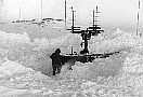 |
Snow cover and sonding tools in 1956 (photo by Prof. N.P. Rusin) |
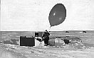 |
Sonding starting in 1956 (photo by Prof. N.P. Rusin) |
 |
Meteorological measurements place in 1956 (photo by Prof. N.P. Rusin) |
 |
Sonding in 1957 (photo by Dr O.Krichak) |
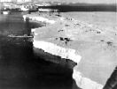 |
Ice barrier near the station Mirny in 1975 (photo by V.V.Evseev) |
 |
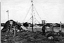
Geodesic marker of the station in 1973 (photo from archive) |
 |
Building of meteolocator (photo from the archive)) |
 |
General view of the buildings on "Radio" hill, March 1978 (photo from the archive) |
 |
Landing of helicopter (photo from the archive)) |
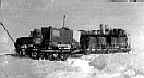 |
Glacio-geophysical laboratory on the route from Mirny to Vostok stations, seasonal 21 SAE, 1975 (photo from the archive of 21 SAE) |
[Top]